Finding Hendre'r Ywydd
, 20 December 2011
I have grown very fond of Hendre'r Ywydd Uchaf. I can smell wood-smoke in the office and it's got me looking forward to Spring, when I'll hopefully be spending more time there, getting to know the building from the inside out. Even if you have visited St Fagans many times, you may not have stayed a long while in there. It is quite a bare building, partly due to the fact that furniture from its period of construction – the early 1500s – need more TLC than can be provided in an outdoor display, and so are tended to in the galleries. Also, there's no chimney, so it can be quite a troublesome building to work with, and even visit, if the smoke is not behaving as it ought to.
The fire behaving nicely at a recent living history demo, with Sally Pointer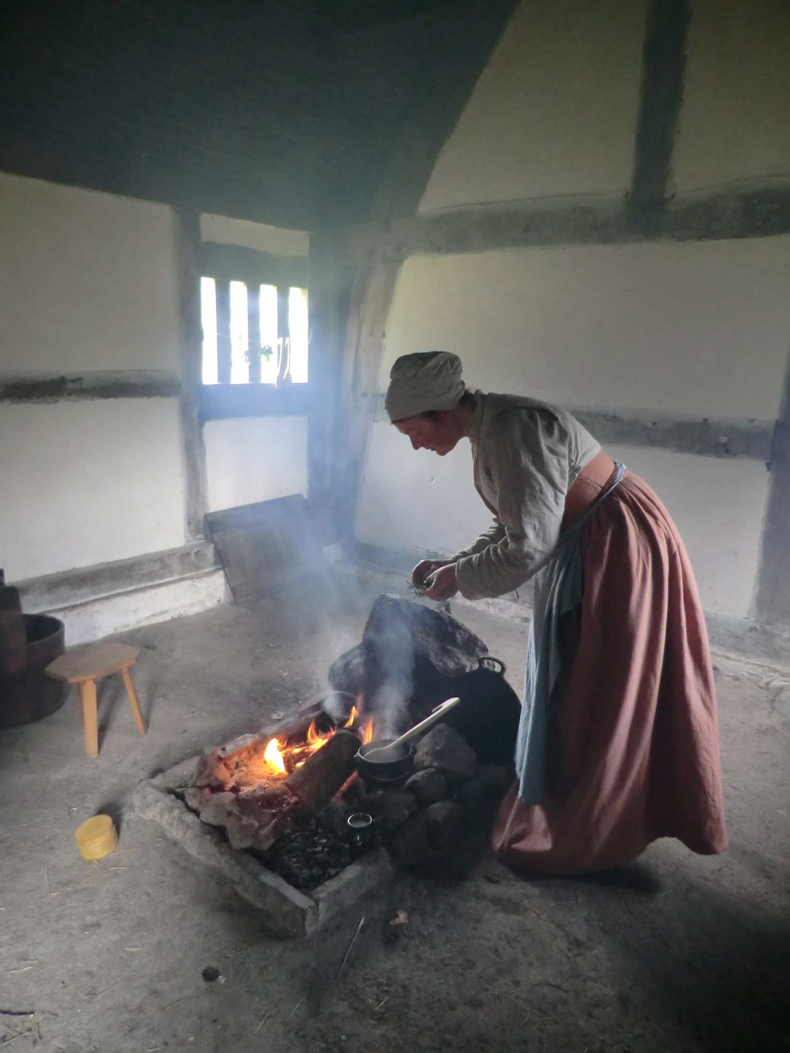
It's a timber-framed building, moved here from Denbighshire in the 1960s but lived in, quite comfortably it seems, until 1954. I hope to find out more about the place, and how it was used, by using a variety of skills and sources. After cooking and interpreting in there over the summer, I'm really looking forward to getting my hands dirty and seeing how it works as an Early Tudor household.
Moving headlong into a Tudor way of life at this time of year may be ill-advised (especially since I have no saltfish and this year's attempt at storing apples has been fuzzier than anticipated), so I'm taking the time to pore over sources relating to the building and its original context.
Dismantling Hendre'r Ywydd Uchaf, c. 1964. The 1500s frame had been left almost unaltered - a corrugated roof, chimney, glass windows and that chap with a cigarette being the most noticable modern additions. 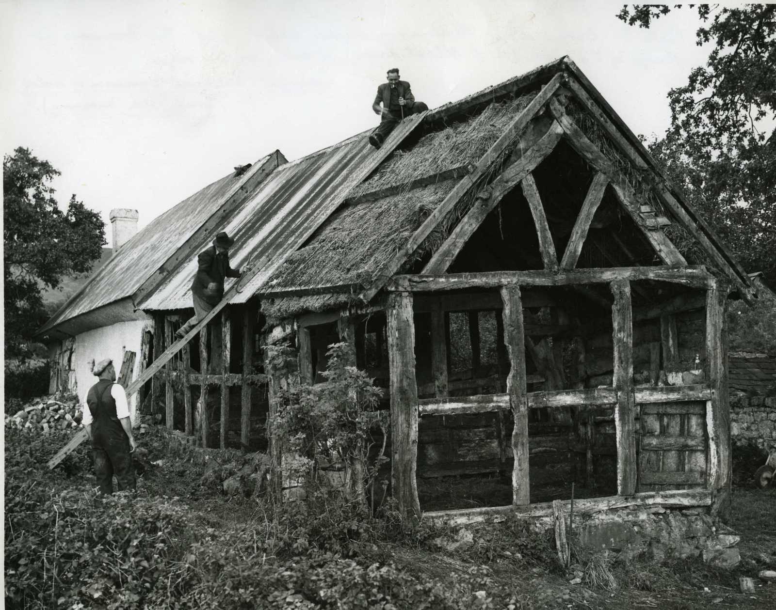
There's so much material to explore. Scholars and local historians have written widely on a range of families, buildings, industries and events from Denbighshire in the Early Modern period. I have on my desk a great big pile of articles, ready to be marked with pink and yellow stripes. But you've got to start somewhere. I decided first to find the building's original location.
It's somewhere around here...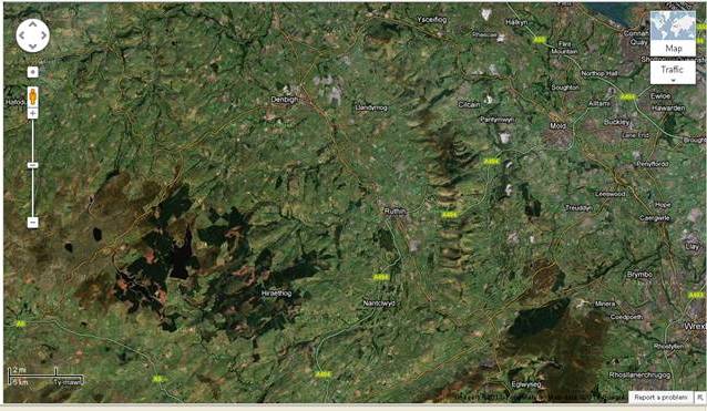
Hendre'r Ywydd was originally built in the parish of Llangynhafal, near Rhuthun. I am quite familiar with the area, but had never been able to put my finger on the house's original site; remembering instead the high hedges and spaghetti-thin roads of Dyffryn Clwyd. Thankfully, for every building we move, we create an archive of its context and original location. These archives are usually second-to-none:
Numbering a doorway, St Teilo's Church (1985)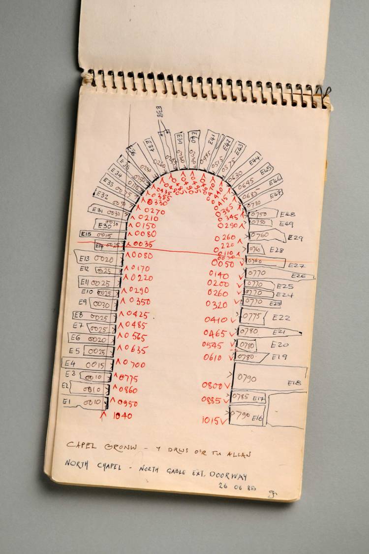
Unfortunately, on this occasion, our forebears did not think to leave enough clues in there to allow for easy pinpointing. Rifling through photos of cruck frames, cow stalls and hazel matting, I came across two shadows of evidence. A copy of a copy of a copy of an 1830s tithe map with no scale, and a transparency with no key. Both featured a strip of land which tapered at one end. This was where, in 1508, Hendre'r Ywydd Uchaf was built.
Map drawn by member of Ffoulkes family. Hendre'r Ywydd is at the bottom left of the strip of land.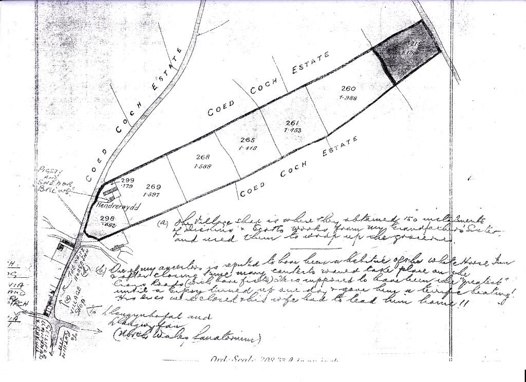
It takes a while to get your eye in, so I google-mapped the parish to see if there were any surviving field systems like the one featured on both maps. Going in cold was a bad idea.
I remember when all this were just fields...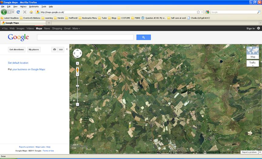
I resolved to have another go once I'd chipped away a little more. It was tempting to rely on google maps for place names and postcodes, but our landscape has changed so much, and in fits and starts, since 1500, that the information was of no use for this particular task. Or at least, if the information looked useful, there would be no simple way of checking its veracity. I stared at the shapes on the tracing, trying to memorise the placement of streams, trackways and field systems.
Tracing of undated map, showing original location of Hendre'r Ywydd Uchaf
In the midst of all these abstract shapes, I called to mind another thread of research I'd been doing, using the Royal Commission's Coflein Database. In trying to build up a bit of context, I've been looking at other surviving houses from the area, reading up on their construction and dating. Coflein supplies you with an OS grid reference for every recorded historic building and monument in Wales. You can look at the Coflein archive for Hendre'r Ywydd here.
I still had in my possession a grab-bag of data. Some abstract shapes, some numbers and some very powerful satellite data courtesy of google and NASA. Thankfully, I didn't have to go far in order to make sense of it. Our library at St Fagans has a cache of Ordnance Survey maps, and the grid reference narrowed it down substantially, as you'd expect. The detail of their maps is mesmerising, and after some careful examination and help from our Curator of Historic Buildings, we pinpointed the location, in amongst a few other houses, confusingly also called Hendre'r Ywydd.
Detail, showing Llangynhafal Parish and Hendre'r Ywydd (1956). Here' "Hendre'r Ywydd" is also used as a name for the hamlet itself. Mapping courtesy of Ordnance Survey. 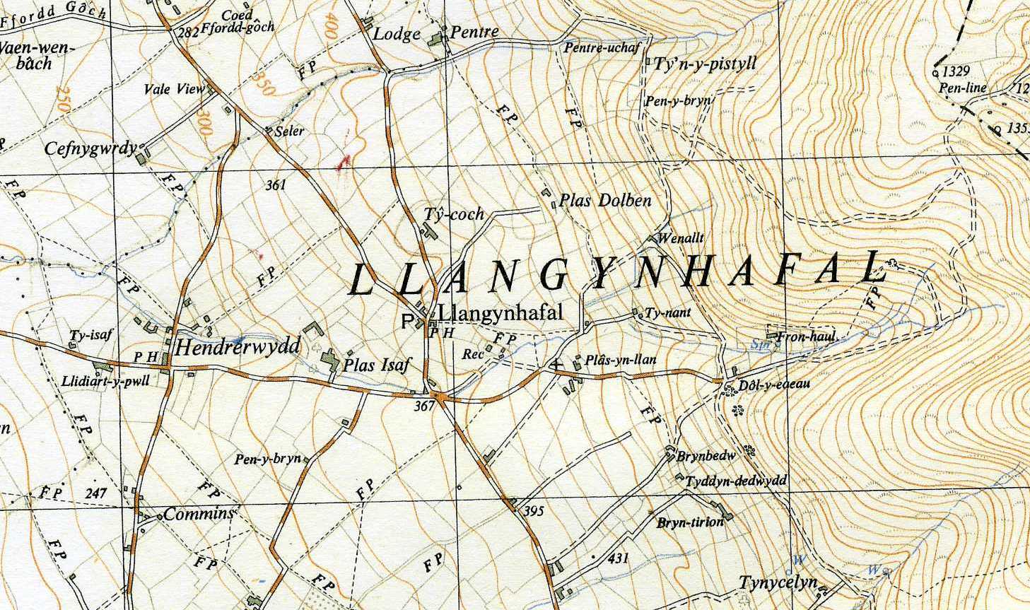
On closer inspection, someone possessing a disregard for conventional, proper, archive-based behaviour had been there before us and marked the map with a tiny blob of red ink.
When I had been brought round with some smelling-salts, I applied the information I'd gathered to the satellite map, and was finally able to find that little strip of land. It's still intact, to a degree, and still maintains a tapered side, as we see on the map. The road twists slightly just as it does in the drawings:
Hendre'r Ywydd, Llangynhafal (1508-1964)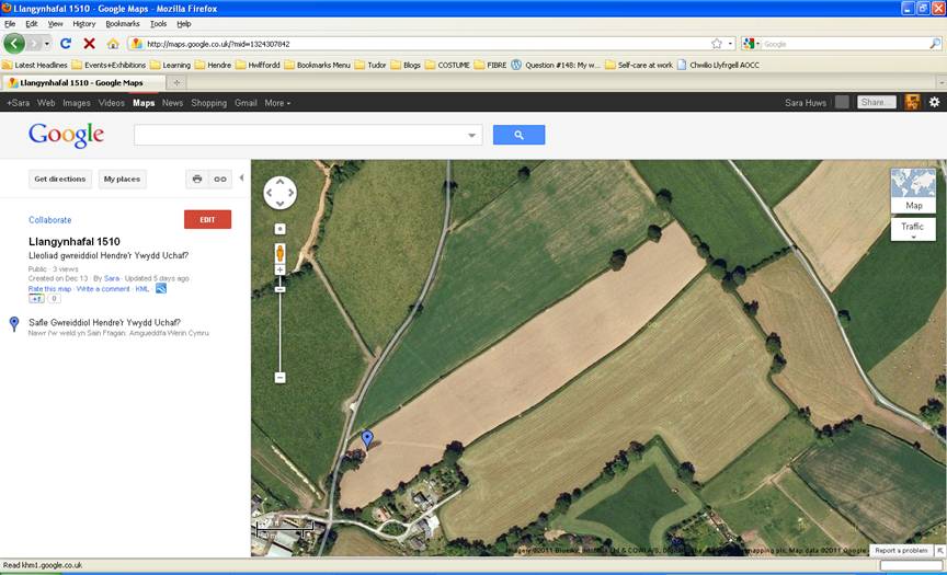
The last thing I wanted to do, after this, was pay it a visit. I find the house replaced with a field of corn. Uninspiring as it may appear, this is where I happily find my feet, as I venture into 1500s Denbighshire.
You can visit, too, by clicking here:
View Llangynhafal 1510 in a larger map
Comments - (2)
Since that time I’ve lived in England, but my family continued to live in Hendrerwydd and so I always ‘came back home’. I now live in Hendrerwydd permanently, and can still identify the exact spot where Hendrerwydd Ucha’ , the long dwelling, housing people, animals and fodder, was located.
There was another similar ancient dwelling nearby called Ty’n y Pistyll. It was demolished in the 50s by its then owners - an act of vandalism which, I’m sure, would never be allowed now.
Hendrerwydd is the name of the hamlet in which the house is located, which may have given rise to some confusion.
Should you have any questions, please email me and I will try to answer them to the best of my ability, although I did move from the area about 50 years ago.
I have visited Hendrerwydd Uchaf on a couple of occasions, and hope to do so again in the next few years.
Regards
Bryn