Stormy Winter
, 17 January 2014
Happy New Year Bulb buddies! I hope you all had a fun Christmas.
It has been a very stormy in the last few weeks in many parts of the UK. Weather scientists at the Met Office say that this is due to the jet stream – a narrow band of fast moving winds high up in the atmosphere. The jet stream blows from west to east across the Atlantic Ocean and can bring us stormy weather.
December 2013 was the windiest month in the UK since January 1993. It has also been very rainy - in Scotland December was the wettest month since 1910. That means it hasn’t rained that much in Scotland for over 100 years! What has the weather been like where you live?
All this rain and stormy weather has meant that there have been floods in parts of England, Wales and Scotland, and sadly some people’s houses were flooded at Christmas. In areas close to the seaside giant waves also caused flooding.
SUPER SCIENTIST CHALLENGE:
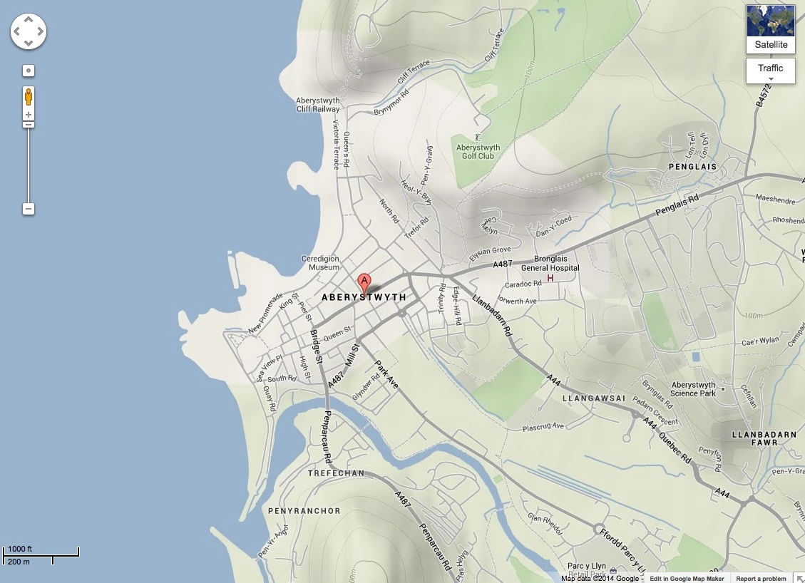
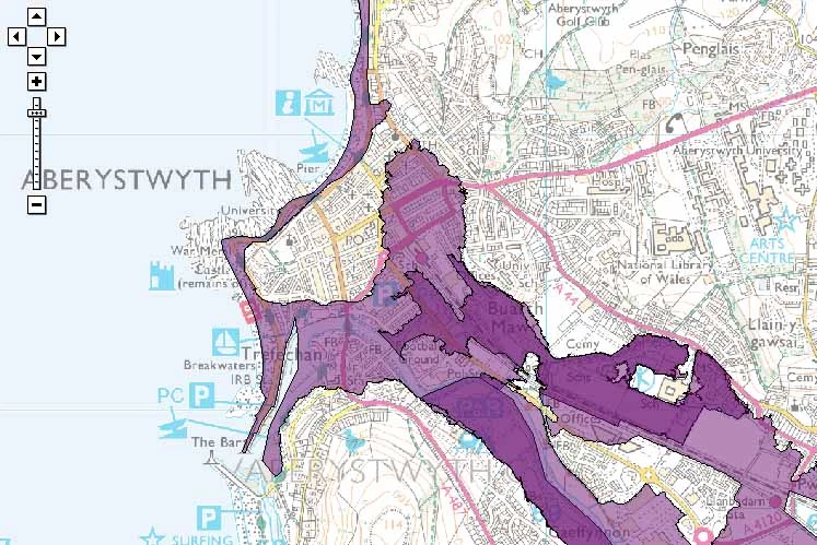
Why do some areas flood and others don’t? Use these maps to investigate!
Study the first map of Aberystwyth in Wales, where there has been flooding. Can you see the wiggly lines called ‘contour lines’ that show the shape of the mountains and hills? Can you see the sea and the river shown in blue? When rain falls in the surrounding area it runs down the hills into the river then into the sea. If there is very heavy rainfall the river may flood. If it is very stormy there may be very large waves. Where do you think it might flood? Hint – flooding can happen in low lying areas and areas near rivers and the sea. This link has some animations about the different factors that cause a flood.
Study the second map from the Environment Agency – the purple areas show where there is risk of flooding. Is the flood risk where you thought it would be?
Now you can investigate the area where you live…
First search for your school on the first map. Can you see any contour lines? Where is the high land and the low land? Is there a river, lake or the sea nearby? Where might it flood?
Next search for your school on the second map. Make sure you tick the two boxes ‘Flood Warning areas’ and ‘Flood Alert areas’ on the left of the page, flood risk areas will then show up in purple. Is there a flood risk in your area? Is the flood risk where you thought it would be?


