The Dynamic World

Meteorites

30 July 2008

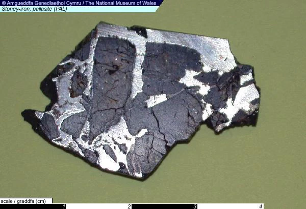
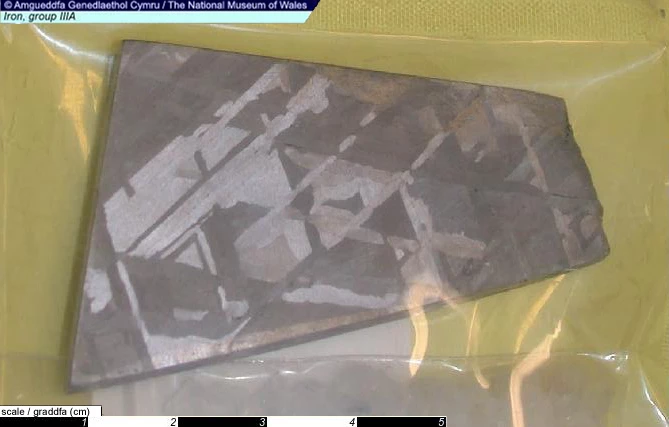
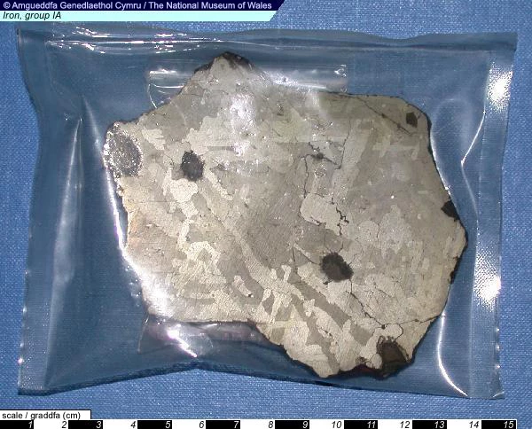
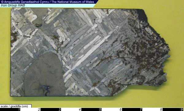
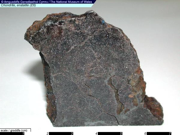
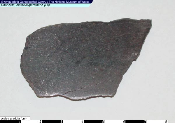
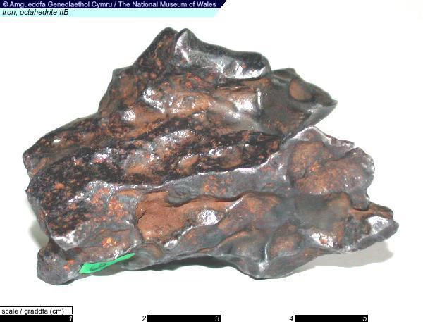
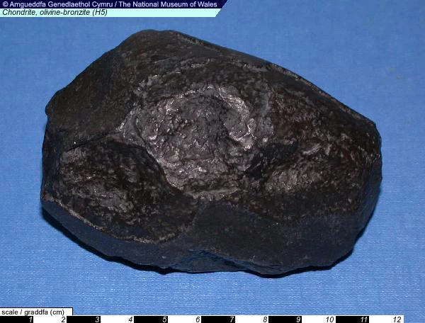
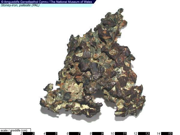
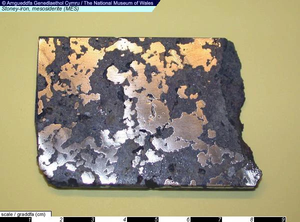
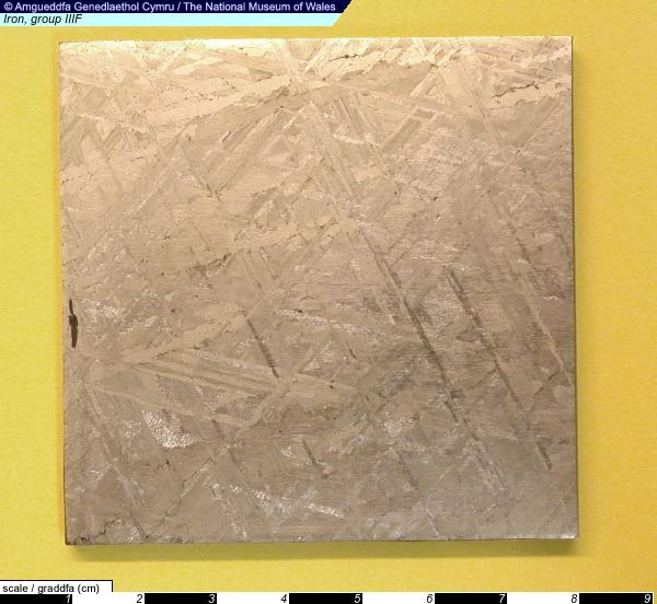
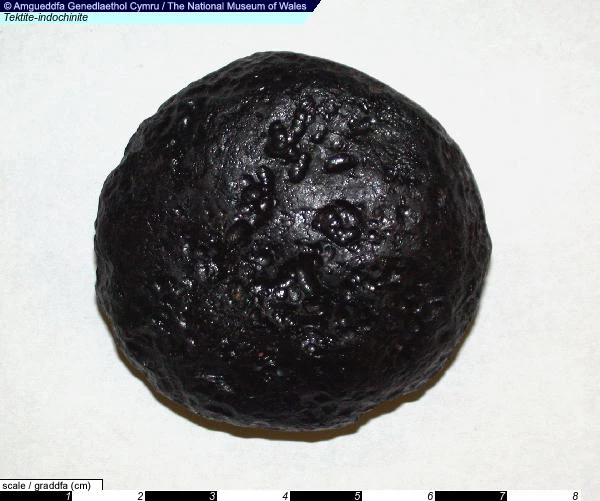
Meteorites are natural pieces of rock that fall to Earth from outer space. As they pass through the atmosphere, the outer layers are heated by friction, causing them to glow brightly and giving rise to the visual phenomena of a shooting star.

Some meteorites are as old, or older, than the age of the Earth. Their chemical composition preserves information on the earliest history of our Solar System and can give clues to how they, and our planet, might have formed.

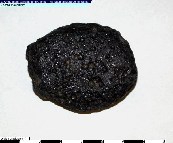
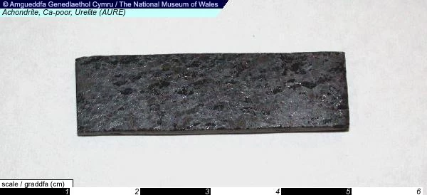
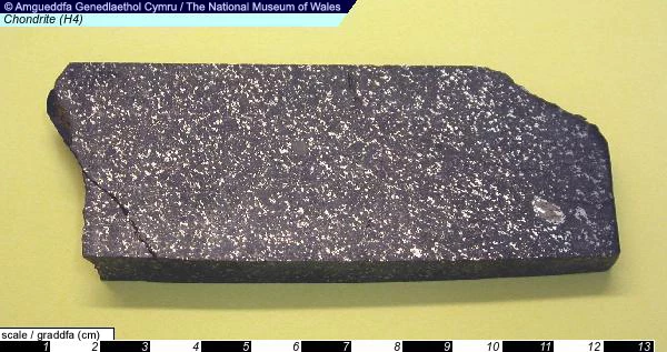
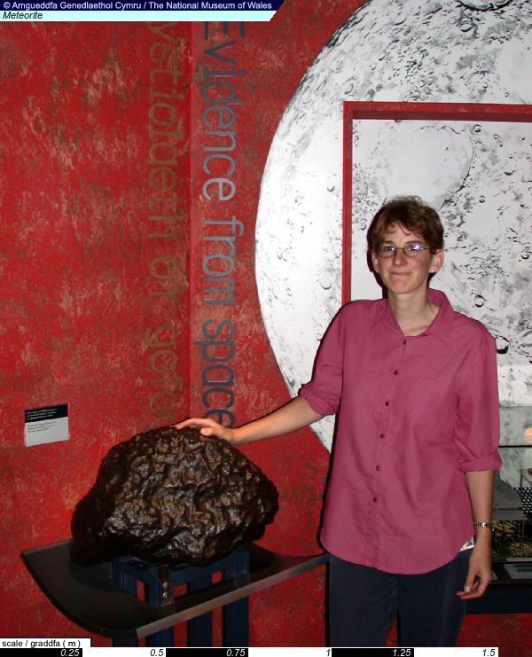
Below is a selection of images from the Meteorite collections held at Amgueddfa Cymru - click on an image to find out more.

When Antarctica went into the deep freeze

19 May 2008

Sampling ancient mud cores in Tanzania

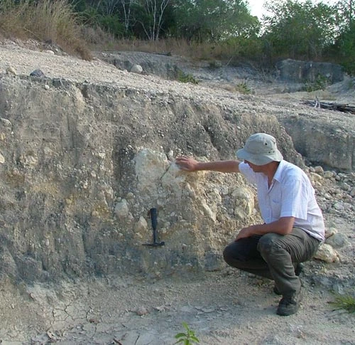
A member of the team looking at the top layer of sediment, deciding where best to sample to get different time intervals.

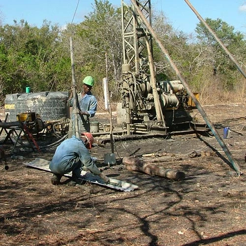
 Bringing up a core of mud from 34 million years ago

Bringing up a core of mud from 34 million years ago

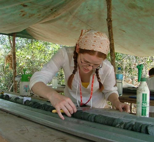
a scientist describing and sampling the core

After the core is brought up it is laid out for scientists to describe and take samples.

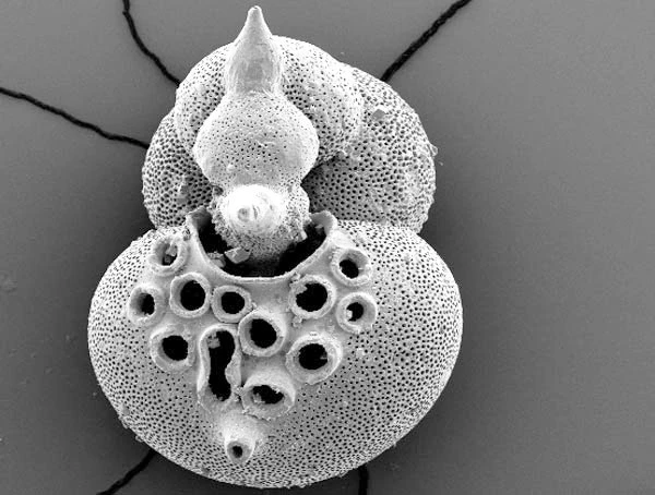
Extreme close up of the 35 million year old foram: Cribrohantkenina inflata.  discovered in the cores from Tanzania.

Extreme close up of the 35 million year old foram: Cribrohantkenina inflata. discovered in the cores from Tanzania. More images of these intricate forams can be seen in the 'Up close with Nature' gallery.

Scientists from Amgueddfa Cymru – National Museum Wales and Cardiff University have found new evidence of past climate change, which helps solve some of the mystery surrounding the appearance of the vast ice-sheet in Antarctica 34 million years ago.

Antarctica hasn't always been covered with ice – the continent lay over the south pole without freezing over for almost 100 million years. Then, about 34 million years ago, a dramatic shift in climate happened at the boundary between the Eocene and Oligocene epochs. The warm greenhouse climate, stable since the extinction of the dinosaurs, became dramatically colder, creating an "ice-house" at the poles that has continued to the present day.

Global cooling

Many climate scientists are involved in trying to figure out what caused this climate shift. This should tell us more about how the climate responds to major controls like changes in the Earth's orbit around the sun, and the concentration of greenhouse gases in the atmosphere.

Past climate changes can be recorded by studying tiny microfossils in layers of deep sea mud. Up until now, scientists found that the oceans appear to have warmed up during this big climatic shift. Their studies suggested that warming seemed to coincide with ice-sheets appearing in both Antarctica and the Arctic. This conflicting evidence, of warming seas while ice-sheets grew, doesn't fit in with computer simulations of the climate at the time; the computer models don't show ice to be present in the Arctic."

Tanzania drilling project

The solution to this icy puzzle has come from a surprising place – Tanzania in East Africa. The Tanzania Drilling Project team, including scientists from Amgueddfa Cymru and Cardiff University, have been recovering cores of ancient mud deposited on the seafloor millions of years ago (which has since been geologically uplifted into land).

The Tanzanian cores are special because large thicknesses of mud were laid down over a relatively short time, meaning that climate changes through time are seen in great detail. Also, beautifully preserved microfossils are found in the cores.

The Tanzanian cores provide the first really clear picture of how sea-level fall fits in with the climate shift.

Setting the record straight

The chemistry of the Tanzanian microfossils has been used to construct records of temperature and ice volume over the interval of the big climate switch. These new records show that the world's oceans did cool as the ice-sheets appeared, and that the volume of ice would have fitted onto Antarctica. So the computer simulations of climate and the past climate data now match up.

The focus now is to look for evidence of the ultimate cause of this global cooling. The prime suspect is a gradual reduction of CO2 in the atmosphere, combined with a 'trigger' time when Earth's orbit around the sun made Antarctic summers cold enough for ice to remain frozen all year round.

How it works

The shell chemistry of pin-head sized animals called forams can tell us how ocean temperatures changed through time. Forams are great tools for studying climates of the past, which helps us learn about the uncertainties of our future greenhouse climate.

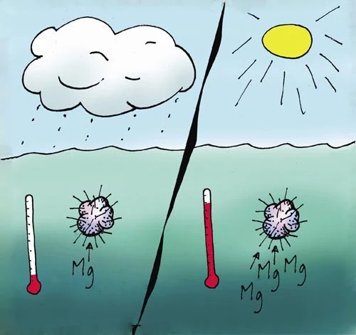
1). Forams take chemical elements from the ocean into their shells, using more magnesium at warmer temperatures.

1). Forams take chemical elements from the ocean into their shells, using more magnesium at warmer temperatures.

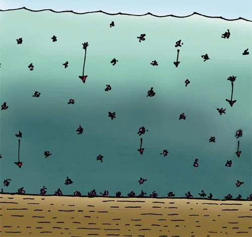
2). Dead forams fall to the sea floor and build up in layers of mud over millions of years.

2). Dead forams fall to the sea floor and build up in layers of mud over millions of years.

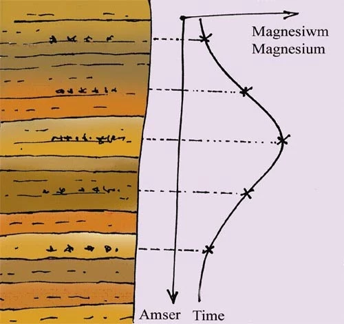
3). Today, going down through the mud layers is like going back in time.

3). Today, going down through the mud layers is like going back in time. If we can measure the magnesium content of forams going down through the mud, it gives us a record of how ocean temperature changed through time - more magnesium equals warmer temperature.

Further Reading

Lear, CH, Bailey, TR, Pearson, PN, Coxall, HK, Rosenthal, Y. Cooling and ice growth across the Eocene-Oligocene transition. Geology 36 (3), 251�254. 2008.

http://www.gsajournals.org/perlserv/?request=get-abstract&doi=10.1130%2FG24584A.1

Earthquakes in Wales

27 March 2008

Although not competing with areas famous for their instability such as western California, Japan or Sumatra, Wales is a region of regular active Earth movements. You might be surprised to learn that at least sixteen significant earthquakes have occurred in Wales during the last century.

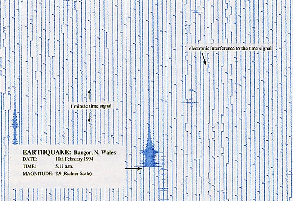
Seismograph showing an earthquake in north Wales in 1994

Seismograph showing an earthquake in north Wales in 1994

Why do earthquakes occur in Wales?

The British Geological Survey (BGS) records around 300-400 earthquakes each year in Britain. Wales, along with the rest of the UK, sits on the European plate, and stress builds up as it is pushed slowly north-eastwards from the Mid-Atlantic Ridge. The stress is released by movement along pre-existing fault planes, causing an earthquake.

Where do earthquakes occur in Wales?

There are several long-active fault systems in Wales. Once faults form, they create weak zones in the crust that can be reactivated time and time again. For example, the fault system running parallel to the Menai Strait between Anglesey and Bangor in north Wales are known to have been active over 500 million years ago and have also been the sites of more recent earthquakes.

The Menai Strait area is the most seismically active area in Wales and one of the most active in the UK. The last major earthquake occurred here in 1984, but many others are known from historical records (including 1827, 1842, 1852, 1874, 1879, 1903). Although many events have been recorded in south Wales, from Pembroke to Newport, only the Swansea area shows consistent activity, with significant earthquakes occurring in 1727, 1775, 1832, 1868 and 1906.


Largest earthquake in Wales for 100 years

The 1984, magnitude 5.4, Menai Strait earthquake was the largest onshore UK event for over 100 years. The epicentre was located in northern Llŷn, north Wales and the quake originated at a depth of approximately 22 km in the Earth's crust.

Another major UK earthquake occurred on 2 April 1990 in the Welsh Borders. This magnitude 5.1 event was felt over an area of approximately 140,000 square kilometres and was followed by six aftershocks. The epicentre was initially identified as being at Bishop's Castle in Shropshire, but this was later revised to a location just inside the Welsh border (latitude 52.43°' N, longitude 3.03° W).

Local damage

In both earthquakes the damage was relatively minor, including cracks in plaster and masonry and collapse of chimneys. In the Bishop's Castle event this was limited to the area immediately around the epicentre.

The only fatality known from any seismic activity in Wales is from a woman falling down the stairs and being killed during the Porthmadog earthquake of 1940.

Recent activity

An earthquake with a magnitude of 4.6 occurred in south Wales on February 17, 2018. According to the British Geological Survey (BGS), its epicentre was between Ystradgynlais and Ystalafera. A Welsh earthquake also occurred in the Bristol Channel on 20th February 2014, and was widely felt across South Wales, Devon, Somerset and western Gloucestershire. The BGS received several reports from the media and local residents describing “felt like the vibration of a large vehicle passing the building”, “the whole house seemed to move/wobble back and forth a few times”..

The magnitude 4.1 earthquake is the largest to hit South Wales since 2013.

Other recent earthquake activity from Wales include:

  • A magnitude 3.8 earthquake on the Lleyn Peninsula on 29th May 2013.
  • Magnitude 2.9 earthquake near Nantyffyllon on 5th June 2009.
  • Magnitude 2.9 earthquake near Llangollen on 30th November 2007
  • A magnitude 2.9 quake in Cardiff on 20th June 2002.

In general, humans cannot feel events of less than magnitude 2.

Recording earthqake activity at Amgueddfa Cymru.

A seismograph at National Museum Cardiff displays output from a local seismometer and allows observation of data from seismic events.

As seismometers are very sensitive to all types of ground vibrations, not only earthquakes but local traffic, trains and even roadworks, it was not possible to locate a seismometer in Cardiff city centre. Instead, data is obtained by a radio link from the nearest BGS seismometer near Newport, Gwent.

Glossary

  • Aftershocks are earthquakes that follow the largest shock of an earthquake sequence; they are smaller than the main event and can continue for years afterwards. The length of the aftershock period relates to the magnitude of the main shock, with large events having more numerous and larger aftershocks for the longer periods.
  • Epicentre this is the point on the Earth's surface above the earthquake hypocentre.
  • Hypocentre this is the place deep in the Earth where the earthquake rupture starts.
  • Intensity is a measure of an earthquake's effect on people and the environment. It is controlled by: the distance from the epicentre, the magnitude of the earthquake and the local geology. In Europe the 12 division EMS 98 (European Macroseismic Scale) is used and in the USA the Modified Mercalli Intensity Scale. For details of the EMS 98 see www.earthquakes.bgs.ac.uk/macroseismics/ems_synopsis.htm.
  • Magnitude is a measure of the strength of an earthquake. This is a logarithmic scale, which means that for each whole number increase there is a ten-fold increase in ground movement. There are several types of magnitude scale, but the 'Richter Scale'(ML — magnitude local) is the one used most commonly in the UK for 'local' earthquakes.
  • Plate. The outer layers of the Earth's crust and mantle are divided into segments known as plates, which are in constant motion. The process by which plates move is know as plate tectonics.
  • Seismometers work by measuring the position of a weight, to which a coil is attached, relative to a magnet in a frame. Vibrations cause movement of the coil and the generation of an electrical current which is then recorded by a seismograph. Seismometers, are highly sensitive, and can record the slightest of movements that are totally unfelt by humans.
  • Seismographs record the motion detected by the seismometer. This is either on a paper trace or as electronic data. Time markers record the precise time a seismic event reaches the seismometer. By using data from at least three seismographs the position of an earthquake can be calculated.

For current earthquake data see: http://earthquake.usgs.gov/earthquakes/ & http://www.earthquakes.bgs.ac.uk/ & http://www.emsc-csem.org/

Museum records largest earthquake in UK for 25 years

28 February 2008

A scan from the seismograph at National Museum Cardiff.

A scan from the seismograph at National Museum Cardiff showing the Market Rasen earthquake on 27 February 2008 at 00:57.14 GMT. The shock waves were recorded by a seismometer located near Newport, south Wales, and transmitted to the seismograph at the Museum.

The seismograph at National Museum Cardiff has recorded the largest onshore seismic event in the UK since 1990.

The earthquake was recorded by the Museum's seismograph at 00:57.14 GMT 27 February. This has been identified as the Magnitude 5.2 earthquake detected by the British Geological Survey. The epicentre was initially reported as located just north of Market Rasen, Lincolnshire, at 00:56.47 GMT.

The earthquake waves took just 27 seconds to travel the 158 miles between Market Rasen and the Museum's seismometer near Newport, south Wales. This means that the earthquake's waves were travelling at approximately 5.85 miles per second.

This is the largest onshore event in the UK since the Magnitude 5.1 earthquake at Bishops Castle in the Welsh Borderland on 2 April 1990.

The Market Rasen event was felt by people as far afield as Newcastle, Yorkshire, London, Cumbria, the Midlands, Norfolk and parts of Wales. Damage to roofs, walls and chimneys around the epicentre area were reported and one person was injured in Wombwell near Barnsley, South Yorkshire as a result of falling masonry.

Aftershock

Earthquakes of this size are typically followed by smaller earthquakes or 'aftershocks'. A magnitude 1.8 earthquake was recorded in the region just a few hours after the main event.

A detailed investigation is required to establish the geological structure responsible for the main earthquake. The Geological Survey has already calculated that the quake occurred at a depth of around 18km. This suggests it most likely occurred along an ancient fault in Precambrian rocks, such as those that underlie much of Wales.

The exact fault along which the quake occurred is unlikely to be exposed at the surface as younger Palaeozoic and Mesozoic rocks (Carboniferous, Permian, Triassic and Jurassic, for example) overlie the Precambrian rocks in the Market Rasen area.

The magnitude 5.4 Lleyn Peninsula earthquake of 19 July 1984 remains the largest recorded onshore earthquake in the UK.

Information from:

The oldest rocks in Wales

26 July 2007

The oldest objects in the Museum's collections are 4,500 million year-old meteorites from space. However, the oldest objects from Wales are rock specimens from the Old Radnor district, Powys, which formed about 700 million years ago, when Wales as we know it today had yet to take shape.

Molten rock from Avalonia

These rocks form the three small distinctive conical hills of Hanter, Stanner and Worsel Wood, and are composed of gabbro, dolerite, and granite — igneous rocks that were once molten. When these formed, around 700 million years ago, Wales lay deep in the southern hemisphere. Along with England and parts of Newfoundland, New Brunswick and New England it formed part of the mico-continent Avalonia, which lay on the margin of the vast continent of Gondwana.

At this time Scotland was close to the equator, attached to the North American continent of Laurentia, and it was hundreds of millions of years later that it separated and merged with southern Britain.

Very old rocks are also found in Anglesey and the Lleyn Peninsula, and similar rocks probably underlie the whole of Wales. Typically we only see these ancient rocks where they have been brought to the surface by upward movement along major fault zones.

How do we know that these are the oldest rocks in Wales?

These rocks contain no fossils. So how do we know that those from the Old Radnor district are the oldest, and what age they are? The answer lies in the minerals from which a rock is made, and the chemical elements that these minerals contain.

Radioactive decay

Rocks are aggregates of minerals, which in turn are composed of chemical elements. Many elements occur in different forms, or isotopes, and some of these are naturally unstable and change spontaneously into a different element by the process of radioactive decay. This process provides a natural clock that measures the time that has elapsed since the minerals formed. The clock starts to 'tick' as soon as the mineral crystallises.

By using high precision equipment — a mass spectrometer — the proportion of radioactive decay products can be measured. As these accumulate at a constant rate, we can calculate the time necessary for them to have formed. This is typically many millions of years.

The Stanner-Hanter rocks have been dated using two different sets of isotopes. The decay of rubidium into strontium gave an age of 702 ± 8 million years whereas the uranium-lead system provided a slightly more precise age of 710 ± 1.5 million years.

The oldest rocks in Wales, although 700 million years old, are significantly younger than the oldest rocks found in the British Isles and Europe. These are metamorphic rocks from the Isle of Lewis, Scotland, dated at 3,300 million years old.

The oldest rocks in the world

The oldest dated rocks known in the world are 3,962 million years old, and come from Acasta, north-west Canada. Even these were formed from older, as yet undated, rocks.

Samples of the oldest rocks from Wales, the British Isles and the world can be seen in the Evolution of Wales exhibition at National Museum Cardiff.